Arts + Events District Profile – The Seawall
In honour of BC Day, we chose to highlight an area that undoubtedly contributes to Vancouver being ranked as one of the top ranked cities in the world. The Vancouver seawall is the world’s longest uninterrupted waterfront path. It’s a place where both tourists and residents flock to for biking, running, walking, rollerblading, or just sitting and taking in the beautiful city and ocean views.
The paved bicycle/walking path is 22km in total – starting from Coal Harbour, around Stanley Park to English Bay, continuing around False Creek, through Granville Island Vanier Park and ending at Kitsilano Beach. Most of the Stanley Park portion of the wall (9km) was built between 1917 and 1971 and officially declared completed in 1980. Since then, the sea wall route has been extended into the glorious route that exists today.
The Seawall is thoughtfully divided into two sections – one for walkers and joggers (closest to the water), and one for cyclists and inline skaters (inside path). It is now easier than ever to bike the seawall with the addition of Mobi – a bike share system with several stations along the sea wall and throughout Downtown Vancouver. Currently, the closest bike station to The Smithe is on Nelson and Mainland – only a 3 minute walk away. Browse other various stations by using Mobi’s interactive map.
The False Creek portion of the seawall is closest to The Smithe – the nearest access point is beneath the Cambie Street bridge at Cooper’s Park (5 minute walk from your door step). From here you can head west along the water and make your way through David Lam Park, George Wainborn Park and eventually hit Sunset Beach, English Bay and Stanley Park. If you head east along the water you will make your way around False Creek to Science World, Olympic Village and Granville Island. There is certainly no shortage of amazing destinations in either direction.
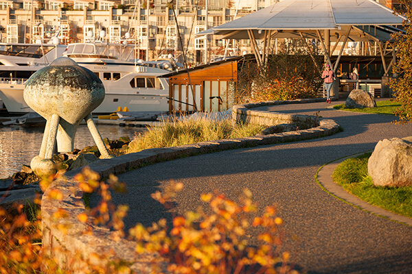
The City of Vancouver describes the walk from Coopers Park to the Burrard Street Bridge:
The north side of False Creek, once home to Expo 86, is divided into several neighbourhoods with each precinct centered on a bay and separated by a public park. The areas have been designed by different teams and constructed with unique materials to provide a distinct feeling.
As you walk along the route notice the changes in colour and design. The starting point for the walk beneath the Cambie Street Bridge at Cooper’s Park is within the Quayside neighbourhood. This area is mainly white and very striking. Travel west along the seawall to Marinaside Crescent you will find the pathway is paved with brick, divided for walkers and cyclists, and lit by oversized lampposts.
The walkway is at a lower level than, or entirely away from the street and offers seclusion from vehicle traffic. The small bays along this walk have marinas with many moored yachts, and ferry docks which have small pedestrian ferries shuttling commuters to and from various points along False Creek.
Living in the same city or within driving distance to the sea wall is great, but being only a few minutes up the road by foot will be wonderful for The Smithe homeowners.
Click here for a printable map of the sea wall path.
Sources:
Original article: The Province
Read original aricle here.